K2: Height, Location and Every Way to Trek There from Pakistan
By Imtiyaz Ahmed Shigri, founder of Chogori Adventure, Skardu · Updated November 2026
K2 (8,611 m) is the second-highest mountain in the world, on the border between Pakistan and China. You can trek to K2 Base Camp from Pakistan: our classic K2 Base Camp Trek takes 21 days from Islamabad and costs $2,300 per person, with permits included. This page brings together everything about the K2 mountain: its height, where it stands, its names and history, all 7 of our K2 treks side by side, what they cost and how to plan.
K2 at a glance
| Fact | |
|---|---|
| Height | 8,611 m (28,251 ft) |
| Rank | Second-highest mountain in the world |
| Where | Karakoram range, on the Pakistan–China border, in Gilgit-Baltistan, Pakistan |
| Local name | Chogori |
| Other names | Mount Godwin-Austen (old), Qogir (Chinese), the Savage Mountain (nickname) |
| Coordinates | About 35.88° N, 76.51° E |
| First ascent | 31 July 1954, by an Italian expedition, on the Abruzzi Spur |
| First winter ascent | 16 January 2021, by a team of ten Nepali climbers |
| K2 Base Camp | About 5,150 m (16,896 ft), about 3,460 m below the summit |
| National park | Central Karakoram National Park |
| Concordia | 4,691 m, where the Baltoro and Godwin-Austen glaciers meet |
| Gondogoro La | 5,585 m, the high pass on the K2 Gondogoro La treks |
| Nearest town | Skardu, about one hour's flight from Islamabad |
| Trek season | June to early October on our fixed departures |
| Trek price | From $2,300 per person for 21 days from Islamabad, permits included |

K2 mountain: what it is and where it stands
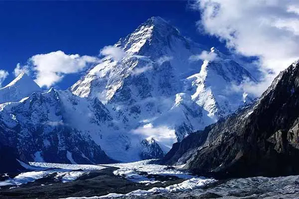
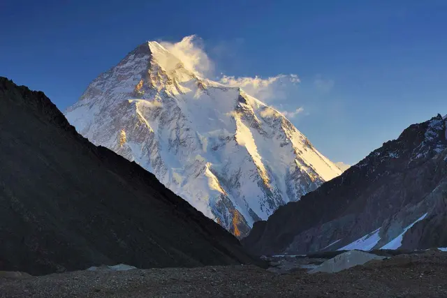
K2 is the second-highest mountain on Earth, 8,611 m (28,251 ft) high, in the Karakoram range on the border between Gilgit-Baltistan in Pakistan and Xinjiang in China. Its summit lies on the border itself. The south side, the side trekkers see, belongs to Pakistan; the north side drops into the Shaksgam valley in China.
On the Pakistan side K2 stands in Shigar District of Gilgit-Baltistan, at the head of the Godwin-Austen Glacier, which flows south into the Baltoro Glacier at Concordia. The nearest town is Skardu, about 1 hour by air from Islamabad. The nearest village is Askoli, the starting point of every K2 trek, about 97 km on foot from K2 Base Camp. There is no road and no village closer than that, and the whole approach lies inside the Central Karakoram National Park.
Which country is K2 in?
K2 is shared by Pakistan and China, because the border runs over its summit. Almost all trekkers and nearly all climbing expeditions come from Pakistan, up the Baltoro Glacier. The Chinese side is reached by a long approach through the Shaksgam valley and sees very few visitors. Every trek on this page starts in Pakistan.
Why you cannot see K2 from the road
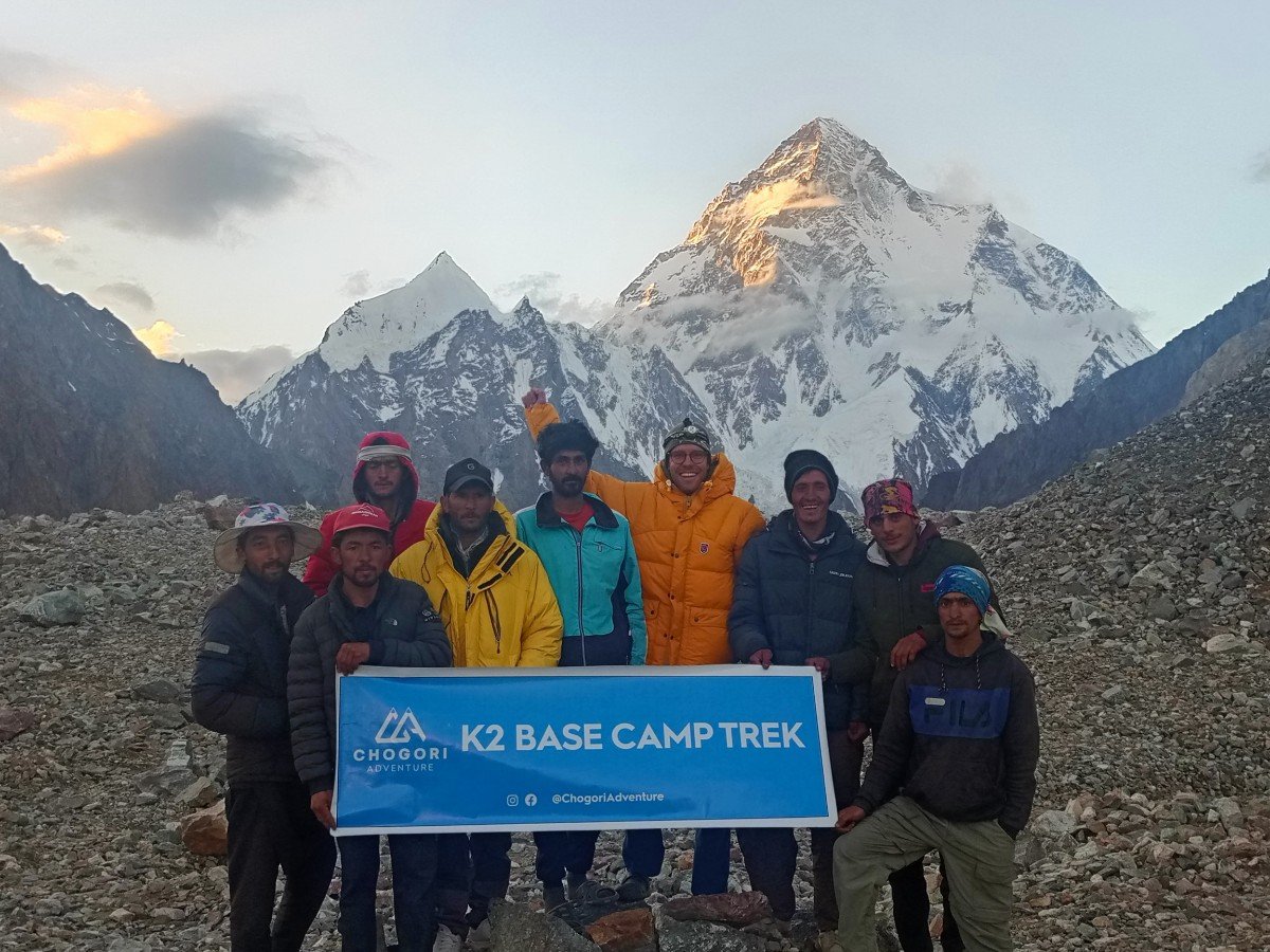
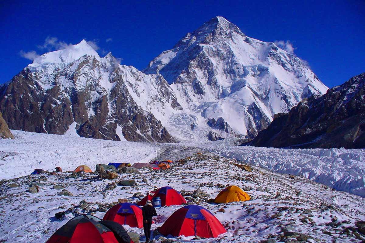
K2 sits deep inside the Karakoram, surrounded by other high peaks. You do not see it from Skardu, from Askoli or from the first days of the trek. The first clear view on the classic route usually comes near Goro II or on the walk into Concordia (4,691 m), on the sixth or seventh day on the trail. At Concordia the whole pyramid appears at the end of the Godwin-Austen Glacier, about a day’s walk away.
How high is K2?
K2 is 8,611 m (28,251 ft) high, the figure used on our site and in most reference works. It is 238 m lower than Everest (8,849 m) and 3,026 m higher than the Gondogoro La (5,585 m), the highest point any trekker reaches on our K2 treks.
The first height was worked out in 1856, from survey stations far away in Kashmir, and it came within a few tens of metres of today’s figure. Later surveys gave slightly different numbers. A survey by Italian and Pakistani scientists in 2014 measured the summit at a few metres below 8,611 m, but 8,611 m remains the standard figure, and we use it on every page.
| Point | Height | Below the summit of K2 |
|---|---|---|
| K2 summit | 8,611 m (28,251 ft) | – |
| The Shoulder (top of the Abruzzi Spur) | about 7,800 m | about 800 m |
| K2 Base Camp | about 5,150 m (16,896 ft) | about 3,460 m |
| Concordia | 4,691 m | about 3,920 m |
| Askoli, where the trek starts | 3,000 m | about 5,610 m |
| Skardu | 2,230 m | about 6,380 m |
K2 is also a very independent mountain. Its prominence, the height it rises above the lowest col that links it to any higher peak, is about 4,020 m, and the nearest higher summit is Everest, more than 1,300 km away. That is why it stands out so clearly above its neighbours from Concordia, even though Broad Peak and the Gasherbrums are all over 8,000 m.
How tall is K2 compared with Everest?
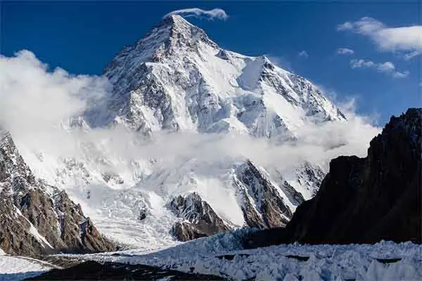
Everest is 238 m higher, but K2 is the steeper and harder mountain to climb. From base camp the summit of K2 rises about 3,460 m in one long pyramid, with rock and ice all the way. Its first ascent came in 1954, a year after Everest, and its first winter ascent in 2021, 41 years after Everest’s. For trekkers the difference is the approach: there are no villages or teahouses on the K2 route after Askoli, and much of the walking is on glacier.
Why is it called K2? The names of the mountain
K2 is a survey label: “K” for Karakoram and “2” because it was the second peak on the surveyor’s list. The mountain has had several other names, and the local one, Chogori, is still used in Baltistan. Our company takes its name from it.
K2: the survey name
In 1856 Thomas Montgomerie of the Great Trigonometrical Survey of India looked north from Haramukh, a mountain in Kashmir more than 200 km away, and saw a line of high peaks on the Karakoram skyline. He labelled them K1, K2, K3 and so on. Most of them later received their local names: K1 is Masherbrum (7,821 m), which you also see from the K2 trek. K2 never did, because no local name was recorded at the time, and the survey label stayed.
Chogori: the Balti name
In Balti, the language of Baltistan, K2 is called Chogori, usually explained as “big mountain” (from Balti words for “big” and “mountain”). The name is used by people in Askoli, Shigar and Skardu, and the Chinese name Qogir comes from it. Chogori Adventure, our company in Skardu, is named after the mountain.
Mount Godwin-Austen
Henry Haversham Godwin-Austen was a British surveyor who explored and mapped the Baltoro region in 1861. The name “Mount Godwin-Austen” was later proposed for K2, but it was never officially adopted. His name stays on the Godwin-Austen Glacier, which runs from Concordia to K2 Base Camp: the last day of walking on every K2 trek.
Is K2 called the Savage Mountain?
Yes. The nickname comes from the American expedition of 1953: after a storm, a fall and the loss of their teammate Art Gilkey, one of the climbers, George Bell, described K2 as a savage mountain that tries to kill you. The name has stuck because K2 is steep, exposed and often stormy, and because the climb has a far higher death rate than Everest. The nickname is about climbing the mountain, not about the trek to its base camp.
K2 geography: glaciers, rock and weather
K2 rises from one of the most glaciated places outside the polar regions. The Karakoram is about 500 km long and holds some of the longest glaciers on Earth outside the poles, among them the Siachen (about 76 km), the Biafo (about 67 km) and the Baltoro (about 63 km), which is the glacier you walk up to K2.
The glaciers you walk on
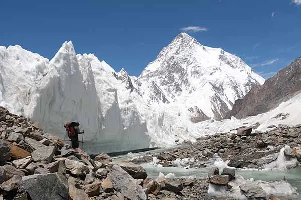
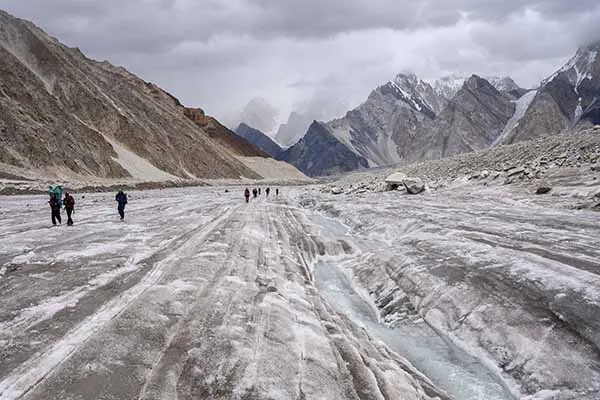
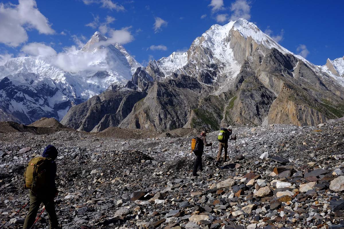
From Askoli the trail follows the Braldu river to the snout of the Baltoro Glacier near Paiju (3,400 m). From there you walk on the glacier, mostly on ice covered with rock and gravel, past Khoburtse, Urdukas, Goro I and Goro II, to Concordia (4,691 m). At Concordia the Baltoro meets the Godwin-Austen Glacier, coming down from K2, and the upper Baltoro, coming from the Gasherbrums and Baltoro Kangri. The K2 Base Camp walk goes north up the Godwin-Austen Glacier, which is whiter and more open. Between Korofon and Jhola you pass the end of the Biafo Glacier, the start of our Snow Lake, Biafo and Hispar La Trek.
What K2 is made of
K2 is built mostly of hard metamorphic rock, gneiss, formed deep in the Earth’s crust and pushed upwards by the collision of the Indian and Asian plates, which began about 50 million years ago. The Karakoram is still rising. The hard rock explains the shape of K2: a steep, almost symmetrical pyramid with sharp ridges, which looks very different from the long, rounded ridges of Broad Peak next to it. Around the Baltoro you also see the granite towers of the Trango group and Paiju, which climbers visit on our Trango Tower Expedition.
Weather on and around K2
K2 lies at the northern edge of the South Asian monsoon. In summer the Baltoro is mostly dry, but storms can still cross the range, and on the summit the wind is strong all year. In winter the jet stream sits over the Karakoram, with winds of well over 100 km/h at the summit and temperatures far below −30°C. That is why winter climbing came so late on K2. For trekkers the useful window is June to early October, and for climbers the main window is from late June to early August.
A short history of K2
K2 was surveyed in 1856, first attempted in 1902 and first climbed on 31 July 1954 by an Italian expedition. The first winter ascent came on 16 January 2021. The key dates:
| Year | What happened |
|---|---|
| 1856 | Thomas Montgomerie of the Great Trigonometrical Survey of India surveys the Karakoram peaks and labels this one K2. |
| 1861 | Henry Haversham Godwin-Austen explores and maps the Baltoro area. |
| 1892 | A British expedition led by Martin Conway explores the Baltoro; he is usually credited with naming Concordia, after a glacier junction in the Alps. |
| 1902 | First attempt on K2, by an expedition led by Oscar Eckenstein, on the north-east ridge; it reaches about 6,500 m. |
| 1909 | The Italian expedition of the Duke of the Abruzzi tries the south-east ridge, now called the Abruzzi Spur; Vittorio Sella’s photographs make K2 famous. |
| 1938 | An American expedition reaches about 7,900 m on the Abruzzi Spur; Bill House climbs the rock crack now called House’s Chimney. |
| 1939 | A second American expedition: Fritz Wiessner and Pasang Dawa Lama reach about 8,385 m without oxygen; Dudley Wolfe and three Sherpas die. |
| 1953 | Third American attempt; Art Gilkey dies, and his teammates build the stone cairn now called the Gilkey Memorial near base camp. |
| 1954 | First ascent, 31 July: Lino Lacedelli and Achille Compagnoni of the Italian expedition led by Ardito Desio, by the Abruzzi Spur. |
| 1977 | Second ascent, by a large Japanese expedition; Ashraf Aman becomes the first Pakistani on the summit. |
| 1986 | Wanda Rutkiewicz becomes the first woman on the summit; the Magic Line on the south-south-west pillar is first climbed; 13 climbers die that summer. |
| 2008 | On 1–2 August, 11 climbers die during and after a crowded summit day; a serac collapse above the Bottleneck, the narrow gully below the summit, cut the fixed ropes on the descent. |
| 2021 | First winter ascent, 16 January, by a team of ten Nepali climbers. K2 was the last 8,000 m peak to be climbed in winter. |
The first ascent, 1954
The 1954 Italian expedition was large, with Italian climbers, Hunza and Balti high-altitude porters, and hundreds of porters on the approach. Lino Lacedelli and Achille Compagnoni reached the top on 31 July 1954. The day before, Walter Bonatti and the Hunza porter Amir Mahdi carried oxygen bottles up for the summit pair, could not reach the top camp before dark, and were forced to spend the night in the open at about 8,100 m, without a tent. Both survived; Amir Mahdi lost toes to frostbite. One member of the team, Mario Puchoz, died of illness on the mountain in June. The history of this expedition, and the part the porters played, is still told in Baltistan.
The Gilkey Memorial at K2 Base Camp
Near K2 Base Camp, on a rocky spur at the foot of the mountain, stands the stone cairn built in 1953 in memory of Art Gilkey. Since then it has become the memorial for climbers who died on K2 and the nearby peaks, with metal plates and plaques fixed to the rocks. On our K2 treks you visit it on the K2 Base Camp day. Please treat it as you would any memorial: quietly, and without moving or taking anything.
Climbing routes on K2
Most K2 expeditions use the Abruzzi Spur, the south-east ridge climbed in 1954; the Cesen route on the south-south-east spur is the second choice. Both start from K2 Base Camp at about 5,150 m. Other routes are climbed very rarely:
- Abruzzi Spur (south-east ridge): the route of the first ascent and of our K2 Climbing Expedition, with four high camps up to the Shoulder at about 7,800 m.
- Cesen route (south-south-east spur): named after the Slovenian climber Tomo Česen; it joins the Abruzzi Spur near the Shoulder.
- North-east ridge: first climbed by an American team in 1978.
- North ridge: from China, first climbed by a Japanese team in 1982.
- Magic Line, South Face, West Face: very hard routes, climbed by very few teams.
The camps, timings and how a climb is organised are in our K2 climbing guide; the price of an expedition is in what it costs to climb K2. If you are looking for a first 8,000 m peak, compare 8,000 m peaks by difficulty first.
Choose your K2 trek
We run 7 treks to K2. They differ in length (15 to 29 days), where they start (Islamabad or Skardu), whether you cross the 5,585 m Gondogoro La, and whether you join a fixed group or go privately. Every price includes the trekking permit, government fees and the national park fee.
K2 Base Camp Trek
The classic route, back the same way
From $2,300per person
21 days · from Islamabad
Up to 5,150 m · Fixed or private
K2 Gondogoro La Trek
A loop over the 5,585 m pass
From $2,300per person
21 days · from Islamabad
Up to 5,585 m · Fixed or private
K2 Base Camp Trek for Beginners
Shorter walking days, more rest
From $4,500per person
29 days · from Islamabad
Up to 5,150 m · Fixed or private
Concordia K2 Base Camp Trek
Trek only, joins the 21-day group
From $2,000per person
15 days · from Skardu
Up to 5,150 m · Fixed or private
K2 Base Camp and Gondogoro La Pass Trek
The pass in the shortest time
From $2,000per person
15 days · from Skardu
Up to 5,585 m · Fixed or private
K2 and Gasherbrum Base Camp Trek
Two base camps, your own dates
From $3,000per person
23 days · from Islamabad
Up to 5,150 m · Private only
Karakoram K2 Trek
Faster loop for experienced trekkers
From $2,300per person
19 days · from Islamabad
Up to 5,585 m · Private only
Quick comparison
| Trek | Days | Start | Group | From | Highest point |
|---|---|---|---|---|---|
| K2 Base Camp Trek | 21 | Islamabad | Fixed group or private | $2,300 | K2 Base Camp, about 5,150 m |
| K2 Gondogoro La Trek | 21 | Islamabad | Fixed group or private | $2,300 | Gondogoro La, 5,585 m |
| K2 Base Camp Trek for Beginners | 29 | Islamabad | Fixed group or private | $4,500 | K2 Base Camp, about 5,150 m |
| Concordia K2 Base Camp Trek | 15 | Skardu | Joins the 21-day group, or private | $2,000 | K2 Base Camp, about 5,150 m |
| K2 Base Camp and Gondogoro La Pass Trek | 15 | Skardu | Joins the 21-day group, or private | $2,000 | Gondogoro La, 5,585 m |
| K2 and Gasherbrum Base Camp Trek | 23 | Islamabad | Private only | $3,000 (9+ people) | K2 Base Camp, about 5,150 m (and Gasherbrum Base Camp, 5,100 m) |
| Karakoram K2 Trek | 19 | Islamabad | Private only | $2,300 (9+ people) | Gondogoro La, 5,585 m |
The main choice: back the same way, or over the pass?
The K2 Base Camp Trek returns down the Baltoro Glacier the way you came. The Gondogoro La treks climb from Ali Camp over the 5,585 m Gondogoro La, using fixed ropes, and come down into the Hushe valley. That's a longer, harder day, and the pass depends on snow and weather. The fixed ropes are usually in place from mid to late June. Gondogoro La difficulty · Best time for the Gondogoro La
Fixed departure or private trek?
Fixed departures have set dates and take at most 12 people, and you can join one on your own; the dates are on each trip page. Private treks run on your dates, and private groups can be larger. What the K2 trek costs
Which K2 trek fits you? Five examples
The right trek depends on your time, your experience and whether you want the pass. Common cases:
- You have three weeks and want to see K2 up close: the classic K2 Base Camp Trek, 21 days from Islamabad. You walk back the same way, so there is no pass to depend on, and it runs on fixed dates from June to early October.
- You have three weeks, have trekked to at least 4,000 m and are ready for one long day on fixed ropes: the K2 Gondogoro La Trek, the same price, which crosses the 5,585 m pass into the Hushe valley instead of returning on the Baltoro. You don’t need mountaineering experience: our crew fixes the ropes and our guides teach you to use the jumar before the pass. If the pass is too risky on the day, the group walks back down the Baltoro to Askoli.
- You want more rest and shorter walking days: the K2 Base Camp Trek for Beginners adds extra days to the classic route (29 days). You still need an earlier trek to at least 4,000 m.
- You are already in Pakistan, or want to arrange your own flights and hotels: the 15-day trek-only versions from Skardu join the same groups. You must reach Skardu two days before the start date with your original passport, because K2 lies in a restricted area and the passport is needed for the security clearance and the park entry.
- You want two base camps, or a faster private trip: the private K2 and Gasherbrum Base Camp Trek (23 days) adds Gasherbrum Base Camp; the private Karakoram K2 Trek (19 days) is for fit, experienced trekkers.
Want a summit as well? Our K2 Base Camp and Khosar Gang Expedition combines the trek with a 6,046 m peak, and the top five trekking peaks in Pakistan lists other first summits. If you have only a few days in Gilgit-Baltistan, see the places to visit in Skardu before or after the trek.
What does a K2 trek cost?
| Price | |
|---|---|
| Fixed departure, 21 days from Islamabad | $2,300 per person |
| Private trip, 1 person | $4,500 |
| Private trip, 2–4 people | $3,000 per person |
| Private trip, 5–8 people | $2,400 per person |
| Private trip, 9 or more people | $2,300 per person |
| Pakistani citizens | USD 300 less than the prices above |
| Tips for the crew (your choice) | About USD 100–250 per trekker, in cash |
| Climbing gear / sleeping bag rental (if needed) | About USD 60–100 / USD 40–80 |
For everything that is and isn't included, see the full K2 Base Camp Trek cost breakdown.
How to get to K2
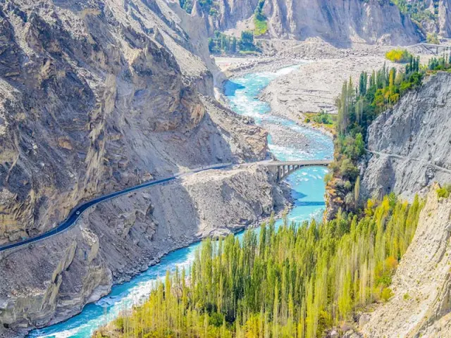
Almost every K2 trek starts in Islamabad. From there it is about an hour's flight to Skardu, the gateway to the Karakoram; if the flight is cancelled by weather, the drive on the Karakoram Highway takes about 20 hours, which is why our itineraries keep a spare day. From Skardu a 5–7 hour jeep ride reaches Askoli (Askole on many maps), the last village, where the walking begins. You need a Pakistan visa and travel insurance that covers helicopter rescue; we arrange the trekking permit.
The route: camps and heights
The classic route goes up the Baltoro Glacier from Askoli to Concordia and K2 Base Camp. The Gondogoro La treks then cross the pass to Hushe instead of walking back.
| Camp or point | Height | Where on the trek |
|---|---|---|
| Askoli | 3,000 m | Last village; the trek starts here |
| Jhola | 3,200 m | First camp, near the Biafo Glacier |
| Paiju | 3,400 m | Rest and acclimatisation day |
| Khoburtse | 3,800 m | First camp on the Baltoro Glacier |
| Urdukas | 4,000 m | Last camp on solid ground |
| Goro II | 4,300 m | Camp in the middle of the glacier |
| Concordia | 4,691 m | Where the Baltoro and Godwin-Austen glaciers meet |
| Broad Peak Base Camp | 4,850 m | On the way to K2 Base Camp |
| K2 Base Camp | about 5,150 m | The goal of the trek |
| Ali Camp | 4,950 m | Below the Gondogoro La (pass treks only) |
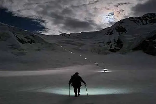
| Gondogoro La | 5,585 m | The high pass, crossed at night on fixed ropes |
| Khuspang | 4,680 m | First camp after the pass |
| Saicho | 3,350 m | Camp in the Hushe valley |
| Hushe | 3,150 m | Village where the pass treks end |
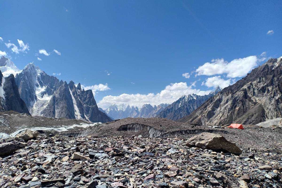
Walking days: distance and time
From Askoli to Concordia is about 85 km of walking over six stages. Most days are 4 to 8 hours on foot, much of it on rough glacier. Times are for a fit trekker at a normal pace; yours may be shorter or longer.
| Stage | Distance | Walking time | Height at camp |
|---|---|---|---|
| Askoli → Jhola | 20 km | 5–8 hours | 3,200 m |
| Jhola → Paiju | 20.5 km | 7–8 hours | 3,400 m |
| Paiju → Khoburtse | 14.7 km | 5–6 hours | 3,800 m |
| Khoburtse → Urdukas | 6.2 km | 4–5 hours | 4,000 m |
| Urdukas → Goro II | 12.2 km | 7–8 hours | 4,300 m |
| Goro II → Concordia | 11.8 km | 5–6 hours | 4,691 m |
Day-by-day details and the route map: K2 Base Camp height, distance and map. For the pass treks: Gondogoro La Trek daily distance and altitude.
The peaks around Concordia
Four of the world's fourteen 8,000 m peaks rise close to Concordia, which is why it is called one of the greatest mountain views on Earth.
From Concordia you look north up the Godwin-Austen Glacier to K2, east to Broad Peak and the Gasherbrums, and south to the ice of the upper Baltoro towards the Gondogoro La. Pakistan has five of the fourteen 8,000 m peaks; the fifth, Nanga Parbat (8,126 m), stands far to the west. Climbers come here for the same peaks on our Broad Peak Expedition and Gasherbrum I and II Expedition, which share base camps with the trek route.
| Peak | Height |
|---|---|
| K2 | 8,611 m, second-highest in the world |
| Broad Peak | 8,051 m |
| Gasherbrum I (Hidden Peak) | 8,080 m |
| Gasherbrum II | 8,035 m |
| Masherbrum (K1) | 7,821 m |
Weather on the K2 trek and at K2 Base Camp
- Summer (June to September): the trekking season. Days are usually dry and clear; at lower altitudes daytime temperatures are around 10–20°C, and at the high camps nights fall to around 0 to −10°C. Storms and strong wind can still happen, and light snow is possible high up.
- Spring (April to May): changeable, with snow still on parts of the route.
- Winter (November to March): heavy snow and extreme cold (as low as −20°C by day at base camp). Not a trekking season.
Month-by-month advice: K2 Base Camp Trek guide.
Visa, permits and insurance
- Visa: you need a Pakistan visa, which you apply for online on the official portal. We provide the invitation letter and help with the process. More in Before you trek in Pakistan.
- Permits: K2 lies in the Central Karakoram National Park, a restricted trekking area. The trekking permit, government fees and the park fee are arranged by us and included in the price.
- Insurance: required. It must cover helicopter rescue and emergency evacuation and trekking up to at least 6,000 m. Mountain rescue in Pakistan uses army helicopters, and payment may be needed in advance, so check this with your insurer.
More on safety, rescue and insurance: Before you trek in Pakistan
Fitness, altitude and health
- Fitness: you need good fitness and an earlier trek to at least 4,000 m. Train with cardio and leg-strength work for long days on uneven ground.
- Altitude: the itinerary climbs slowly, with a rest day in Skardu and another at Paiju. Drink plenty of water and tell your guide about any headache, dizziness or nausea.
- Need a gentler pace? The K2 Base Camp Trek for Beginners has shorter walking days.
How to prepare: K2 Base Camp Trek guide · Baltoro trekking tips.
What to bring
- Your own clothing in warm layers, a waterproof jacket, and well-worn trekking boots.
- A sleeping bag for freezing nights. If you don't have one, you can rent one in Pakistan for about USD 40–80.
- Climbing gear (gaiters, helmet, crampons, carabiners, harness, ascender and descender) can be rented in Pakistan for about USD 60–100 if you'd rather not bring your own.
- Porters carry up to 16 kg of your bag; each extra kilo costs USD 12.
Travelling alone, and women travellers
- You cannot trek the K2 route without a licensed guide and porters; it is a restricted area. But you can book any of our fixed departures on your own and join a group.
- A woman travelling alone gets a separate room and tent if there is no other woman in the group.
- Local custom is to dress modestly: cover your shoulders and legs in public.
Villages on the way: Askoli and Hushe
Askoli (3,000 m) is the last village before the Baltoro Glacier and the start of every K2 trek. Hushe (3,150 m) is where the Gondogoro La treks come out, in a valley known for its Balti villages and peaks. Read more: Askoli Valley · Hushe Valley.
What is included in our K2 treks
- Domestic flights or road transport, and jeeps to and from the trailhead
- Hotels in Islamabad and Skardu on the 21-day treks (1 night in Islamabad and 2 in Skardu on arrival; 1 in Skardu and 2 in Islamabad on return)
- Tents on twin sharing and all meals on the trek
- A licensed guide, cooks and porters (16 kg of your bag; USD 12 per extra kg)
- The trekking permit, government fees and taxes, and the Central Karakoram National Park fee
- Satellite phone for emergencies and a basic first-aid kit
The trek-only versions from Skardu do not include flights or hotels in Islamabad and Skardu. Tips, gear rental, drinks and laundry are extra: see the cost breakdown.
Plan your K2 trek
How hard is it?
Fit trekkers who have trekked to at least 4,000 m can do it, but the days are long and much of the walking is on glacier. Read more: K2 Base Camp Trek guide: difficulty and preparation.
When is the best time to go?
Our fixed departures run from June to early October. The fixed ropes on the Gondogoro La are usually in place from mid to late June. Read more: Best time and weather · Best time for the Gondogoro La.
How high and how far is it?
K2 Base Camp is at about 5,150 m. The trek starts at Askoli (3,000 m) and follows the Baltoro Glacier to Concordia. Read more: K2 Base Camp height, distance and map.
What is the Baltoro Glacier like?
It is the long glacier you walk along to Concordia, surrounded by some of the highest peaks on Earth. Read more: Baltoro Glacier trekking tips.
How hard is the Gondogoro La?
The pass is crossed at night on fixed ropes, with a steep, rocky descent. Read more: Gondogoro La difficulty.
What are the risks?
The main risks are altitude, weather and glacier terrain. Our itineraries climb slowly with rest days, our guides carry a satellite phone and a first-aid kit, and if conditions on the Gondogoro La are too risky, we do not cross. Read more: Before you trek in Pakistan.
Climbing K2
Climbing K2 itself is a mountaineering expedition, not a trek. It is for experienced high-altitude climbers and takes about 50 days. See our K2 Climbing Expedition, and read our K2 climbing guide for the route, the camps and how long it takes.
Why trek to K2 with Chogori Adventure
- A local company, founded in 2015 in Skardu, at the start of the Karakoram, by Imtiyaz Ahmed Shigri
- Local, government-licensed, English-speaking guides, most of them trained in first aid
- Licensed by the Department of Tourist Services (licence no. 2494) and the Gilgit-Baltistan tourism department (licence DTS-GB-055), and a member of the Pakistan Association of Tour Operators
- Offices in Skardu (near Ali Plaza, Hussaini Market, Naya Bazar) and Islamabad (1 Street 2, I-9/1)
- More than 3,000 customers and 500 trips
- Rated 4.9 out of 5 from 47 reviews on Google (November 2026). Read our reviews on Google
- Fixed departures you can join on your own: we group travellers together
Frequently asked questions about K2
Where is K2?
K2 stands in the Karakoram range on the border between Pakistan and China. On the Pakistan side it is in Shigar District of Gilgit-Baltistan, inside the Central Karakoram National Park. Trekkers reach it from Pakistan: a flight from Islamabad to Skardu, a jeep to Askoli, then about 97 km on foot up the Baltoro and Godwin-Austen glaciers to K2 Base Camp.
How tall is K2?
K2 is 8,611 m (28,251 ft) high, the second-highest mountain in the world after Everest, which is 238 m higher at 8,849 m. K2 Base Camp, where the trek ends, is at about 5,150 m (16,896 ft), so the summit rises about 3,460 m above the camp in one steep pyramid of rock and ice.
Is K2 the second-highest mountain in the world?
Yes. At 8,611 m (28,251 ft), K2 is the second-highest mountain on Earth, after Everest (8,849 m). It is the highest mountain in Pakistan and in the Karakoram range. Four of the world’s fourteen 8,000 m peaks, K2, Broad Peak, Gasherbrum I and Gasherbrum II, stand close to Concordia, the glacier junction below K2.
Why is it called K2?
K2 is a survey label. In 1856 Thomas Montgomerie of the Great Trigonometrical Survey of India numbered the Karakoram peaks K1, K2 and so on; “K” stands for Karakoram. Other peaks later got local names, but K2 kept its label. In Balti, the local language, it is called Chogori, and the Chinese name Qogir comes from that.
Why is K2 called the Savage Mountain?
The nickname comes from the American expedition of 1953, when climber George Bell described K2 as a savage mountain that tries to kill you, after the team lost Art Gilkey. K2 is steep, exposed and stormy, and climbing it is far riskier than Everest. The name is about the climb; the trek to base camp is a hard but well-supported trek.
Who first climbed K2?
Lino Lacedelli and Achille Compagnoni of an Italian expedition led by Ardito Desio reached the summit on 31 July 1954, by the Abruzzi Spur. Walter Bonatti and the Hunza porter Amir Mahdi carried their oxygen up the day before and survived a night in the open at about 8,100 m. The first winter ascent was on 16 January 2021.
How long is the K2 Base Camp Trek?
Our classic trek takes 21 days from Islamabad back to Islamabad, with about 97 km on foot each way between Askoli and K2 Base Camp. There are also 15-day trek-only versions from Skardu that join the same groups, a 19-day private Karakoram K2 Trek, a 23-day private trek that adds Gasherbrum Base Camp, and a slower 29-day version for beginners.
Can beginners trek to K2 Base Camp?
You need good fitness and an earlier trek to at least 4,000 m, even on our beginners’ version. If you want shorter walking days and more rest, choose the K2 Base Camp Trek for Beginners (29 days), which adds extra days to the classic route. Train for long days on rough, uneven ground, and walk with a loaded pack before you come.
Can I trek to K2 Base Camp on my own?
You can join any of our fixed departures as one person; we put you together with other travellers, and groups run with 4 to 12 people. Trekking independently is not allowed: K2 lies in a restricted area, and you need a permit and a licensed guide. A woman travelling alone gets her own room or tent.
Do I need a permit?
Yes. The K2 route is in a restricted area inside the Central Karakoram National Park, so you need a trekking permit, government fees and the park fee. All of these are included in the price of our K2 treks, and we arrange them. You also need a Pakistan visa, which you apply for online; we provide the invitation letter.
How much does the K2 Base Camp Trek cost?
A fixed departure costs $2,300 per person for 21 days from Islamabad, with the permit, park fee, hotels, flights or road transport, meals on the trek, guide and porters included. Private groups pay from $2,300 to $4,500 per person, depending on group size. Pakistani citizens pay USD 300 less. Tips and gear rental are extra.
Is the K2 Base Camp Trek harder than Everest Base Camp?
Most trekkers find it harder. K2 Base Camp (about 5,150 m) is a little lower than Everest Base Camp (about 5,364 m), but the K2 route is more remote: there are no villages or teahouses after Askoli, you sleep in tents for about two weeks, and many days are on rough, rock-covered glacier.
How high is K2 Base Camp?
K2 Base Camp is at about 5,150 m (16,896 ft). The trek starts at Askoli (3,000 m) and reaches Concordia (4,691 m) after six walking days; Broad Peak Base Camp, on the way, is at about 4,850 m. On the Gondogoro La treks the highest point is the pass itself, at 5,585 m.
What is the weather like at K2 Base Camp?
In the trekking season, June to September, days are usually dry and clear. At Concordia and K2 Base Camp nights fall to about 0 to −10°C, and light snow is possible even in summer. Lower down, days are around 10–20°C. Storms and strong wind can still come through, which is why our itineraries keep spare days.
Can you climb K2 without experience?
No. Climbing K2 is a 50-day expedition for experienced high-altitude climbers: you need at least one 7,000 m peak, and it is one of the hardest climbs in the world. Without that experience, trek to K2 Base Camp instead: you see the whole mountain from base camp and Concordia without technical climbing.
All our K2 guides
- K2 Base Camp Trek guide: difficulty, best time, weather and preparation
- K2 Base Camp Trek cost: price, what's included and extras
- K2 Base Camp height, distance and map
- Baltoro Glacier trekking tips
- Gondogoro La difficulty
- Best time for the Gondogoro La
- Before you trek in Pakistan
- Gondogoro La Trek daily distance and altitude
- Askoli Valley: the gateway to the Karakoram
- Hushe Valley
- 10 best treks in northern Pakistan
- Top 10 beginner-friendly treks in Pakistan
Not sure which trek is right for you? Tell us your dates and experience and we'll suggest one.
About the author
Imtiyaz Ahmed Shigri founded Chogori Adventure in Skardu in 2015. Our guides are local, government-licensed and English-speaking, and most of them are trained in first aid. We are licensed by the Department of Tourist Services (licence no. 2494) and the Gilgit-Baltistan tourism department (licence DTS-GB-055), and we are a member of the Pakistan Association of Tour Operators, with offices in Skardu and Islamabad.
Rated 4.9 out of 5 from 47 reviews on Google (November 2026). Read our reviews on Google